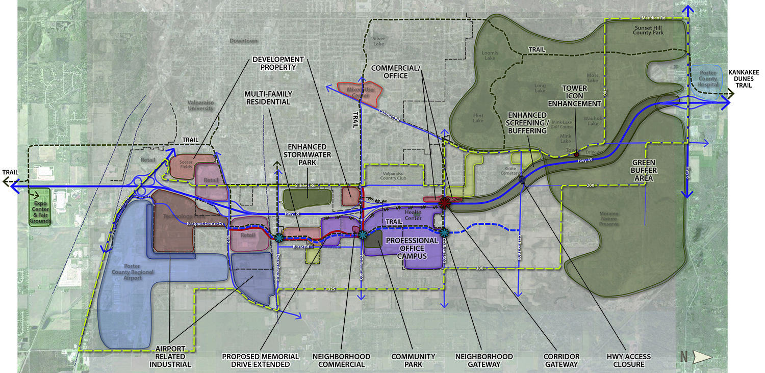
The Corridor Plan was developed to address landscape conservation and development-related issues along a six mile portion of State Route 49; the principal objective of which was to provide planning guidance and physical design direction for urban growth and development, regional change, and environmental management over the next ten to 20 years. A key goal of the Corridor Plan is to encourage professional/office development patterns that limit uncoordinated expansion in order to preserve the corridor’s natural, cultural and scenic resources and amenities for which Porter County is known. An arterial thoroughfare (Memorial Drive Extended) was proposed to run parallel to SR 49 in order to provide access to large portions of developable land, and ensure a coherent pattern of contiguous development that prevents sprawl and preserves open space and rural landscape character. The proposed thoroughfare promotes connectivity and manages access to existing transportation corridors while providing synergies with adjacent, complementary land uses.