
Page 24 - Valparaiso, IN U.S. 30 Corridor Plan
P. 24
Adopted July 25, 2011
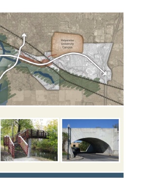
Map 2.4, Natural Features and Constraints
Natural Features & Open Space
The corridor’s natural landscape is largely rolling and moraine- through landfilling and deep pilings. Aside from the pathways
like due to its location on the edge of the Valparaiso Morraine. and linear parks shown elsewhere in this plan, there are no
There are numerous patches of wetlands, woodlands and parks or dedicated open space preserves currently planned
hydric soils in the corridor’s midsection formed by the Salt within a ¼ -mile of the corridor.
Creek and its various tributaries. A large impound area is
located on the southern edge of the corridor to the east of the Zoning
Norfolk Southern right-of-way. The western end of the corridor
is also heavily impacted with wetlands interspersed with rolling Zoning in the corridor east of Hayes Leonard Road consists
countryside just east of IN 250-West. The north side of the mostly of General Commercial. The area west of Hayes
corridor is generally higher in elevation than the south side with Leonard is under County zoning control and is zoned
tree-top views along portions of West and South streets. primarily residential. All new development within the corridor
is subject to the Nonresidential Design Standards of the City’s
The area’s drainage system is largely hidden from view and, Unified Development Ordinance as well as additional special
with only a few exceptions, has not been used as a site amenity standards for the US-30 “signature overlay district”.
by area property owners. There have many instances of
floodplain infill and developers who have gone to extraordinary
lengths to alter the structural suitability of their properties
6